JerCase AI
Links scattered land-case documents to the right cadastral parcel, ranks the candidates and shows the evidence for each match.
- Period
- Jul 2026
- Organisation
- GovTech Camp 2026 (selection stage)
- Role
- Team baash, one of four
- cases × candidates in the reproducible reference set
- 72 × 5
- cases × candidates in the reproducible reference set
- features in the reranker
- 21
- features in the reranker
A specialist in a land department links each incoming document to a parcel by hand, across PDFs, scans, protocols and the cadastre. JerCase AI proposes candidates and shows why — source, reason, date — and leaves the final confirmation to the specialist.
How it works
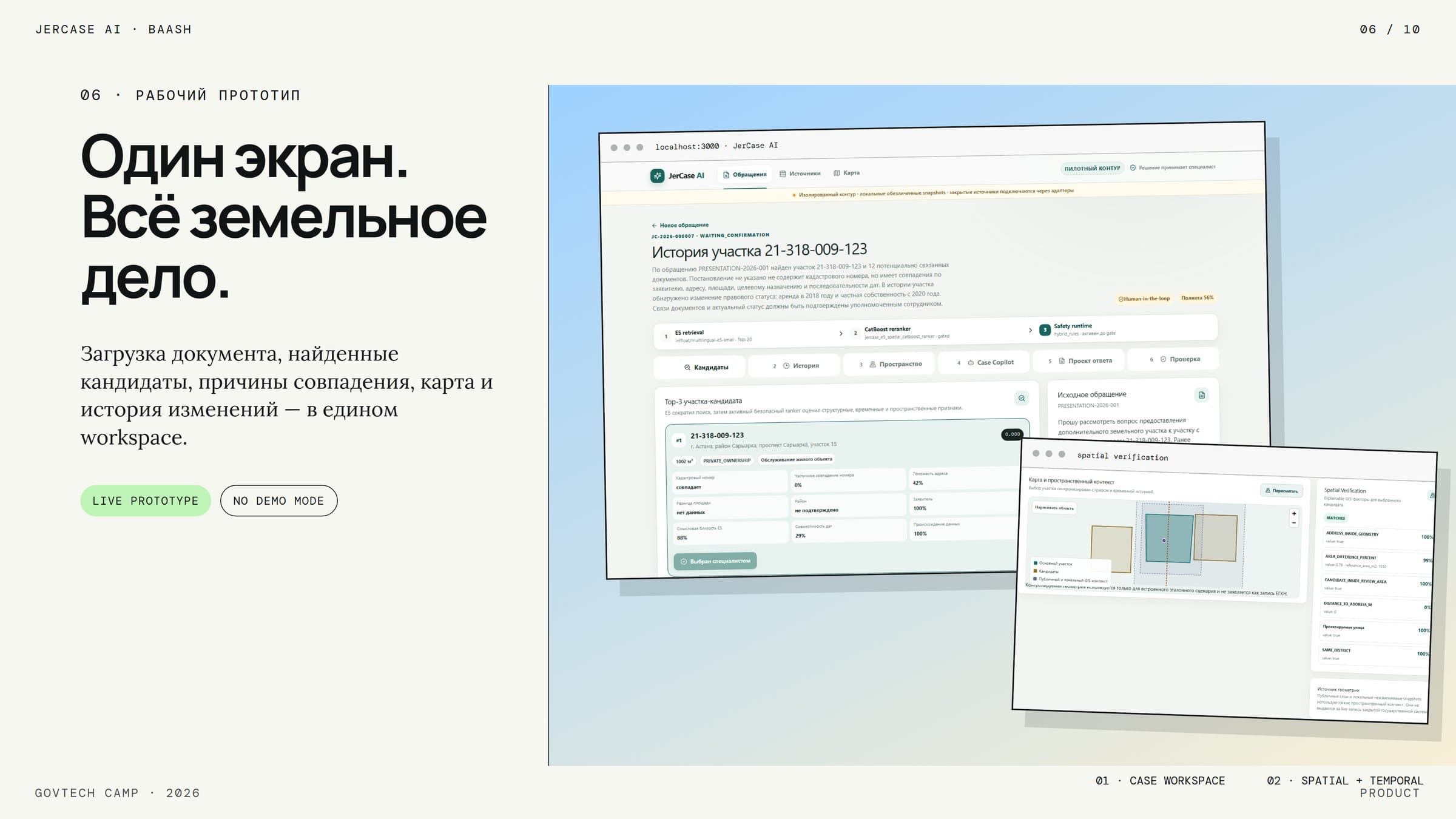
Document text (OCR) → entity extraction → multilingual-e5-small embeddings → semantic top-K retrieval → CatBoost YetiRank reranking on 21 features → confidence and provenance, on a FastAPI/PostGIS backend with a Next.js workspace.
What is verified
Only a reproducibility check on a reference set of 72 cases × 5 candidates (360 pairs); the team’s own slide says it is not a production accuracy metric. Data were open, anonymised or simulated.
Figures
- InterfaceNext.js workspaceappeal · candidates · map · Decision Guard
- Application APIFastAPI + workflowingestion · reconstruction · review
- IntelligenceOCR · E5 · CatBoost · PostGISretrieval · ranking · spatial / temporal
- Evidenceprovenance layerdocument → entity → parcel → decision
- DataPostgreSQL · PostGIS · pgvectorsingle store for the case and geometries
- eOtinish
- EGKN
- Documentolog
- Lotus
- Archive
- Document textOCR / native text
- Entity extractioncadastre number · address · date
- E5 embeddingsmultilingual-e5-small
- Candidate retrievalsemantic top-K
- CatBoost rerankingYetiRank · 21 features
- Confidence + provenanceverifiable result
Automated A person decides
- Uploaddocument
- OCRtext
- Entitiesnumber · address
- RetrievalTop-K
- Reranking21 features
- Confidencescore
- Checkmap · time
- Confirmationspecialist
Evidence
01What was verified, what is expected, and what a pilot would still have to measure
From the presentation
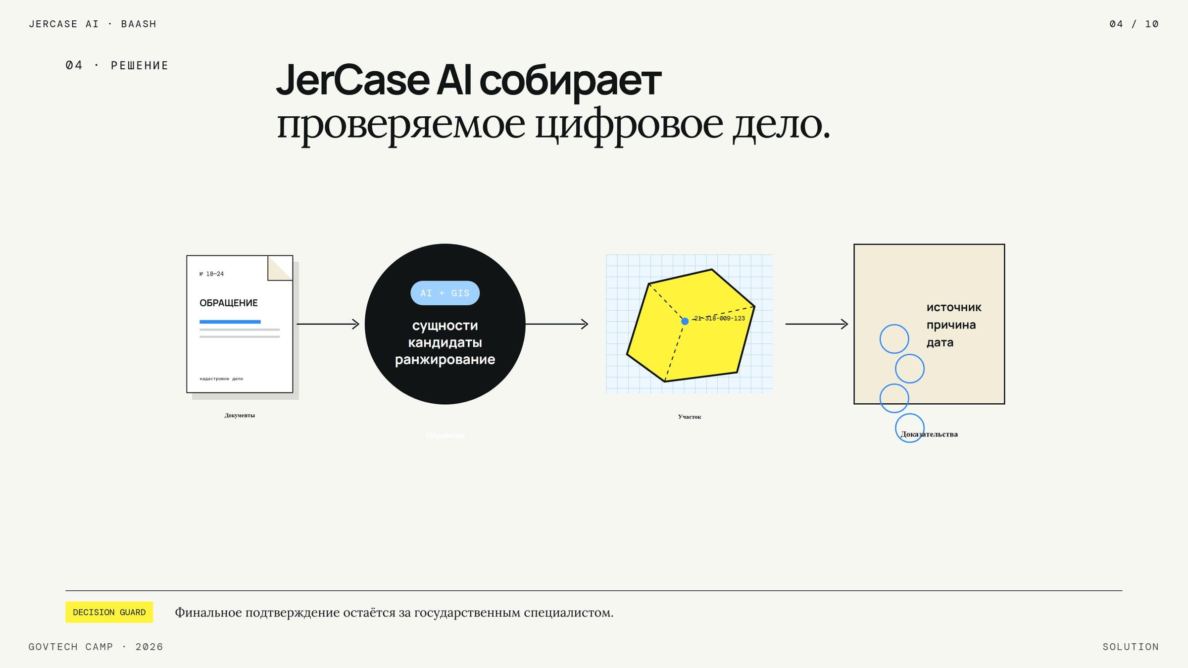
Solution overviewFlow from an incoming document through entity extraction and candidate ranking to a land parcel and its evidence (source, reason, date), with final confirmation left to the specialist. 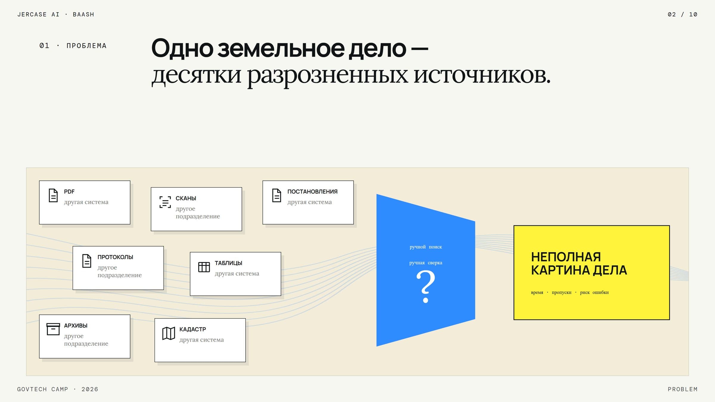
Problem: scattered sourcesDiagram of one land case drawing on scattered PDFs, scans, resolutions, protocols, tables, archives and cadastre records, leading to an incomplete picture. 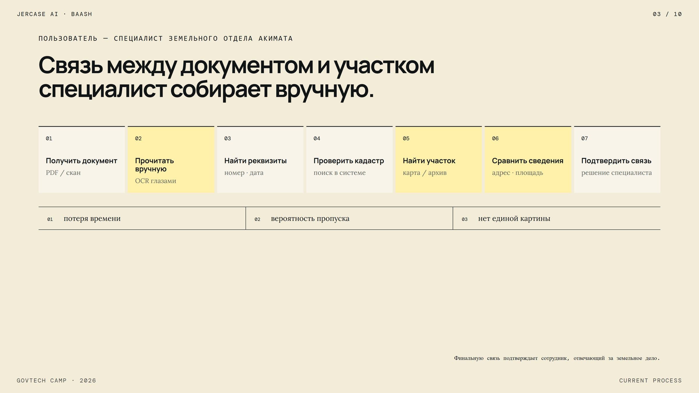
Current manual processSeven manual steps a land-department specialist performs to link a document to a parcel, with the resulting losses (time, missed records, no single picture). 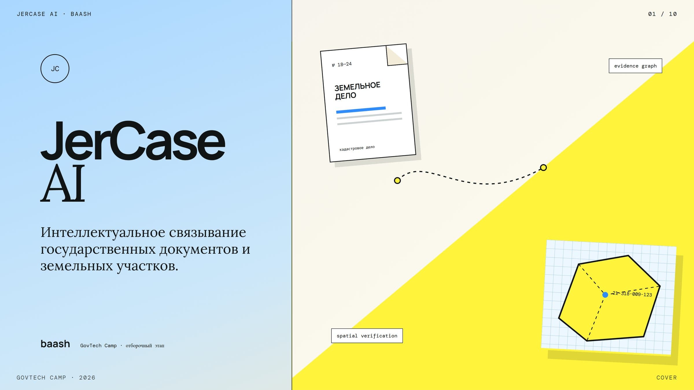
CoverCover slide: "JerCase AI — intelligent linking of state documents and land parcels", team baash, GovTech Camp 2026 selection stage.